Location
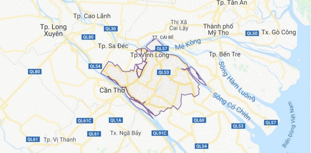
Situated between the Tien and the Hau rivers, Vinh Long Province is bounded by Tien Giang Province on the north, Dong Thap Province on the north-west, Tra Vinh Province on the south-east, Hau Giang and Soc Trang provinces on the south, and Can Tho City on the south-west.

The terrain is quite flat. The complex network of rivers and canals make convenient transportation. The soil is rich in alluvium, favorable for rice and various fruit cultivation.
Climate
The dry season lasts from December to April, the rainy season lasts from May to November. The annual average temperature is 270C. The average rainfall is from 1,300mm to 1,500mm.
Silt from Tien and Hau rivers has raised the level of the field. The majority of inhabitants live on farming, fruit planting and cattle rising.
Tourism
Coming to there, visitors have a chance to walk among the trees, relax in hammocks, try all kinds of delicious tropical fruits in the gardens of An Binh and Binh Hoa Phuoc islands. Several popular places are Mr Sau Giao’s Flower Garden, Mr Muoi Day’s Stilt-House, and Mr Hai Hoang’s Old House.

Vinh Long has many pagodas, communal houses such as Van Thanh Temple, Long Thanh Communal House, Tinh Xa Ngoc Vien, Phuoc Hau, Tien Chau, Saghamangala pagodas…
Transportation
Vinh Long is 70km from Mytho, 34km from Can Tho and 136km from Ho Chi Minh City. The inter-province bus station is 5km from the centre of Vinh Long. There are buses between Vinh Long and Ho Chi Minh City, Can Tho, Mytho, Long Xuyen, Sa Dec, Rach Gia, and other Mekong Delta destinations. National Highway No.1A and No.53 also run through the province.


